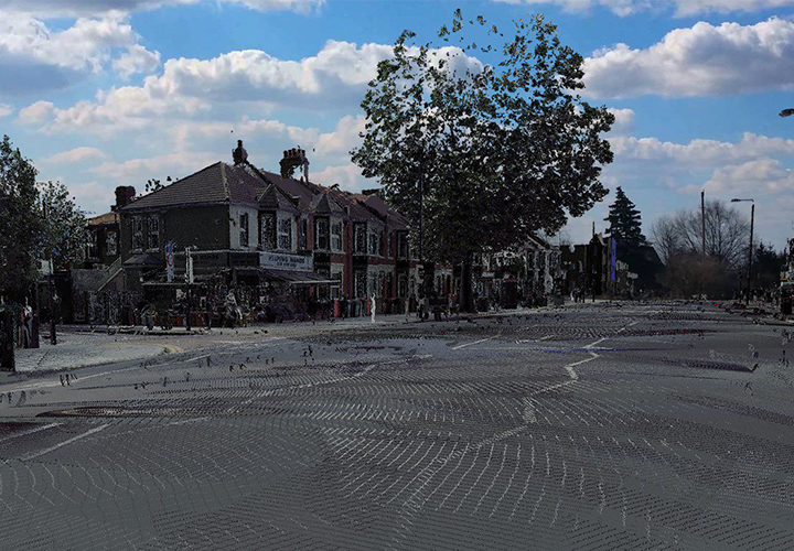
Data Capture
The data capture of the point cloud information allows us to provide clients with a visual representation of a completed survey. Following processing and registration of each scan we can quickly provide a digital walk-through of the conducted survey to provide the client with an early visual representation of information to help understand and interpret survey details, especially useful for early design review or if they have not yet been to site.
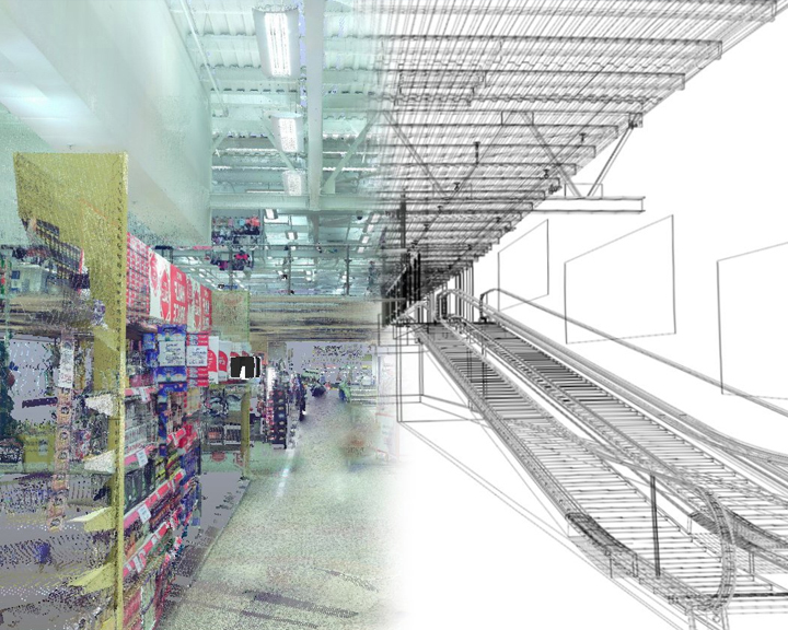
Point Cloud
Point cloud information derived from scans is made up of millions of data points with each data point containing a geometric and intensity value with potentially an RGB value derived from colour capturing from an integrated camera. This enables us to process survey information at a comprehensive level. Point cloud information can then be developed into a full 3D CAD model utilising latest software tools to provide the survey in digital format.
3D Scan To BIM
Combining our 3D laser scanning services, processing of point cloud data, development of full 3D CAD model and our BIM facilities, we can extend the CAD models capabilities creating an intelligent data rich model that can deliver more than just a visual representation. This allows us to incorporate the BIM process into existing sites, retrofits or refurbishments with the principles of data rich information modelling normally associated with new site development. Clients also have the ability to take measurements directly from the scan information we can provide, prior to the equivalent CAD model reproduction, to assist with those tight timescales.